Did you know that there is a National Park within the United States that is 440 miles long? Yep! It's called the Natchez Trace. Meandering across three states, it begins (or ends whichever way you look at it) in Natchez, Mississippi and ends in Nashville, Tennessee.
The "Trace", as it is called by those familiar with it *two thumbs pointing to moi*, is a paved road with NO ADVERTISEMENTS ALLOWED. NO BILLBOARDS. You don't realize how much visual noise you are used to seeing (especially in the Southern States), until you don't see ANY; then it is like, "Oh My Stars!" (You like that Southern saying I just threw in there?)
Also, NO COMMERCIAL VEHICLES are allowed to travel on The Trace. So basically, you will see cars, personal trucks, motorcycles (lots and LOTS of motorcycles), mobile homes and trailers, and lots and lots of bicycles.
Oh, and wild turkeys. Or "chuck-a-lucks" as they are called here.
First I should explain what the Trace is. Better yet, read the sign.
Capice?
From so many people walking this pathway, the trail sunk down. Thus the name of this particular area.
Just to give you a perspective of how deep this pathway is, here is a picture of my husband (you remember him from the letter, "J", don't cha?) walking the path.
Click here to view a map of the Trace. The map includes the mile markers and the various sites to see. Like this gorgeous Cypress Swamp, for example.
Or this mound that was left that was part of a huge plaza that held ceremonies and led to an Indian temple.
 |
| Emerald Mound |
This is typical of what the road looked like in many parts.
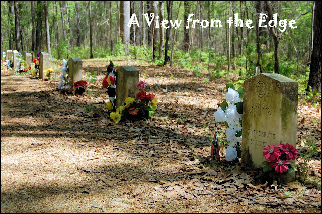
It was not unusual for us to come across gravestones while we were stopped to looked at a different item listed on the map.
or
The scenery was beautiful.
We crossed two spectacular bridges on the Trace.
 |
| John Coffee Memorial Bridge |
 |
| Double Arch Bridge |


9 comments:
Very nice pictures, Pat. It looked as if Jim was walking through the bottom half of a tube.
Finally, a place I've been!
While we didn't travel all of it, nor did we see all that you saw, we did drive a good portion on our meandering trip south to New Orleans. It is a beautiful road to travel.
It looks beautiful. Funny to think of how hard it must have been for those walking the Sunken Trace back all those years ago, now it just looks like a very calming walk in the woods.
nice trail
Wow! Never heard of it, and to think it's a National Park. I'm quite impressed. Sure glad we have cars now to get us along the trail.
This is FABULOUS! I never heard of this before!!
I have heard of that but have never visited any of it. Since I wasn't raised in TN, I did not know that history of it but you did an excellent job educating us! We really are truly blessed to have the transportation that is available to us today. Have you ever been to Reelfoot Lake in West Tennessee? We used to live near that area and enjoyed visiting there and seeing the cypress trees - - - - such interesting root structure.
This is on my to do list now, Thanks, we are going to NOLA and Natchez with a stop in Nashville, soon.
Oh, man! The history you have seen. I am very envious.
The only history I have is the old sunken road here that used to be, the artifacts traces and the tall tales I remember.
Post a Comment